
Local Trail
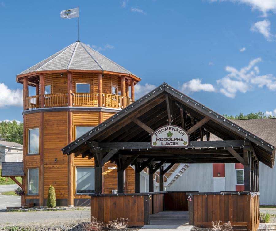
Kedgwick Pioneer Tower
Only 300 m (1000 ft) off the Northern Quad Route (Trail #10), this Kedgwick landmark offers a rest stop for a nice place to eat lunch and a tourist information centre located in the Kedgwick Pioneer Tower, a reconstruction of a pioneer building from centuries ago.
The Pioneer Tower is home to our famous Pioneer Tree, a unique masterpiece, created entirely by our local artists. It symbolises the forest of yesteryear that have seduced pioneers to settle in this beautiful corner of our province.
Rest Area Location: Lat: 47.64555 Lon: -67.357094
Local Trail
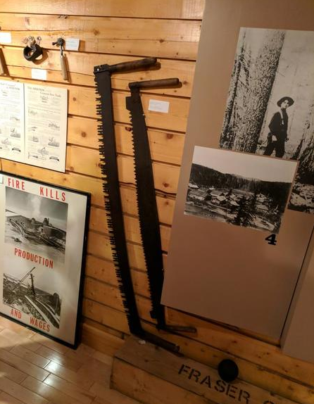
Kedgwick Forestry Museum
Only 300 m (1000 ft) off the Northern Quad Route (Trail #10), is the Kedgwick Forestry Village and Museum.
The location is a tribute to the logging industry of New Brunswick and the lumberjacks that built the industry. The village has replica log cabins along with a large number of artifacts explaining the strong ties Kedgwick has with the industry. In the summer months the museum offers guided tours, which should not be missed.
Museum Location: Lat: 47.65693 Lon: -67.34028
Local Trail
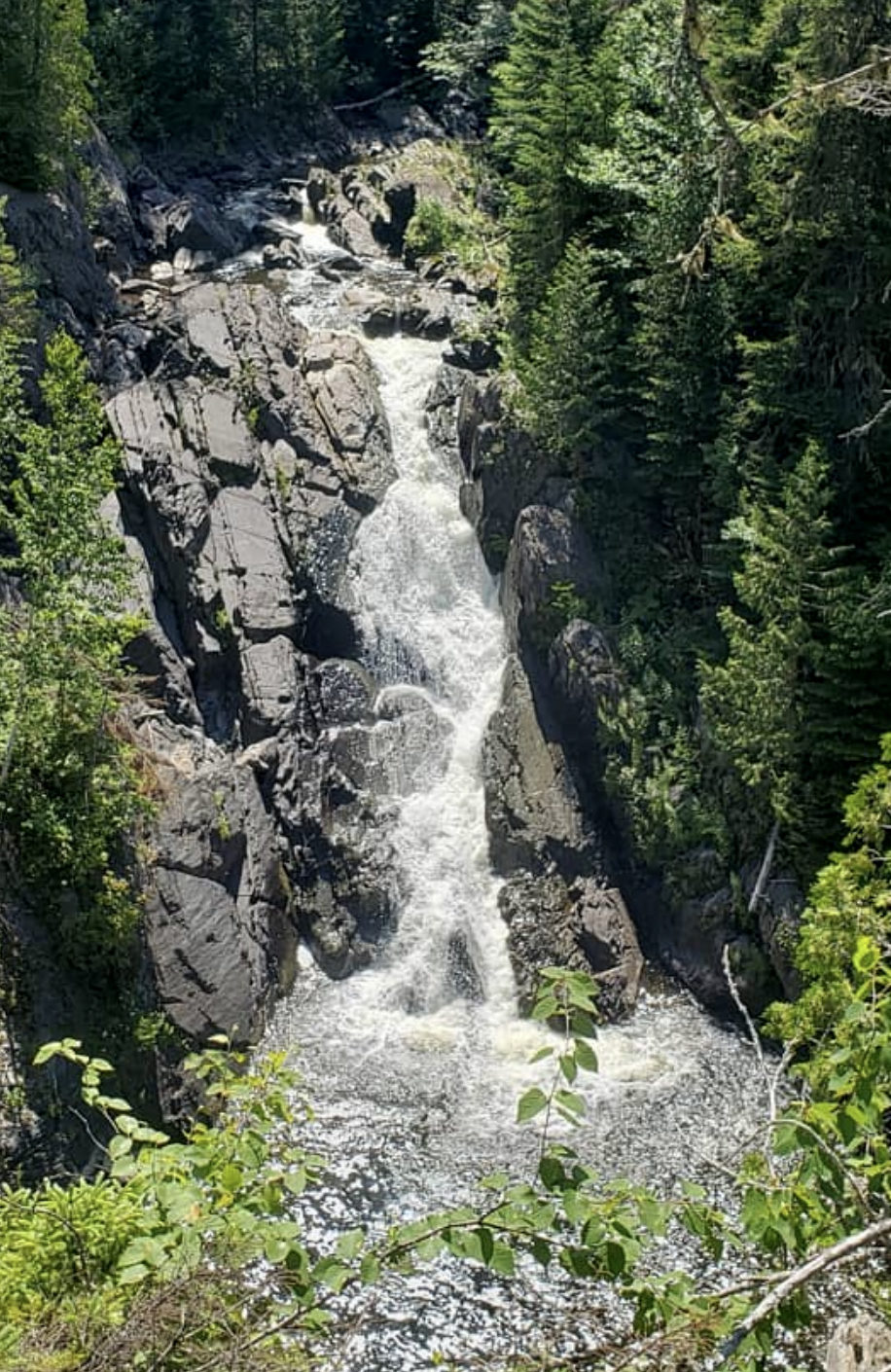
Whites Brook Falls
Follow a 7.5 km (4.5 mile) local trail to one of the best waterfalls in Restigouche County, if not all of New Brunswick. Near the waterfall, the ATV trail turns into a walking path with reminders of a structure that has long been removed. A large rope barricade has been installed by the local landowners to maintain a buffer between the trail and the cliffs that surround the waterfall. The waterfalls itself is 25 m (75ft) tall.
Falls Location: Lat: 47.741667 Lon: -67.270278
Local Trail
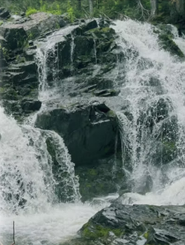
Fallbrook North Falls
Following a 5 km (3 miles) detour off the Northern Quad Route (Trail #10) brings you to Fallbrook North and Fallbrook South Falls.
Once you reach the end of the local trail, begin hiking down a short trail to the edge of the brook. Once there, follow the brook upstream and once near the falls look for a rough trail that will lead down to the base of the falls. Further upstream you will find Fallbrook South Falls.
North Falls Location: Lat: 47.76421 Lon: -67.25553
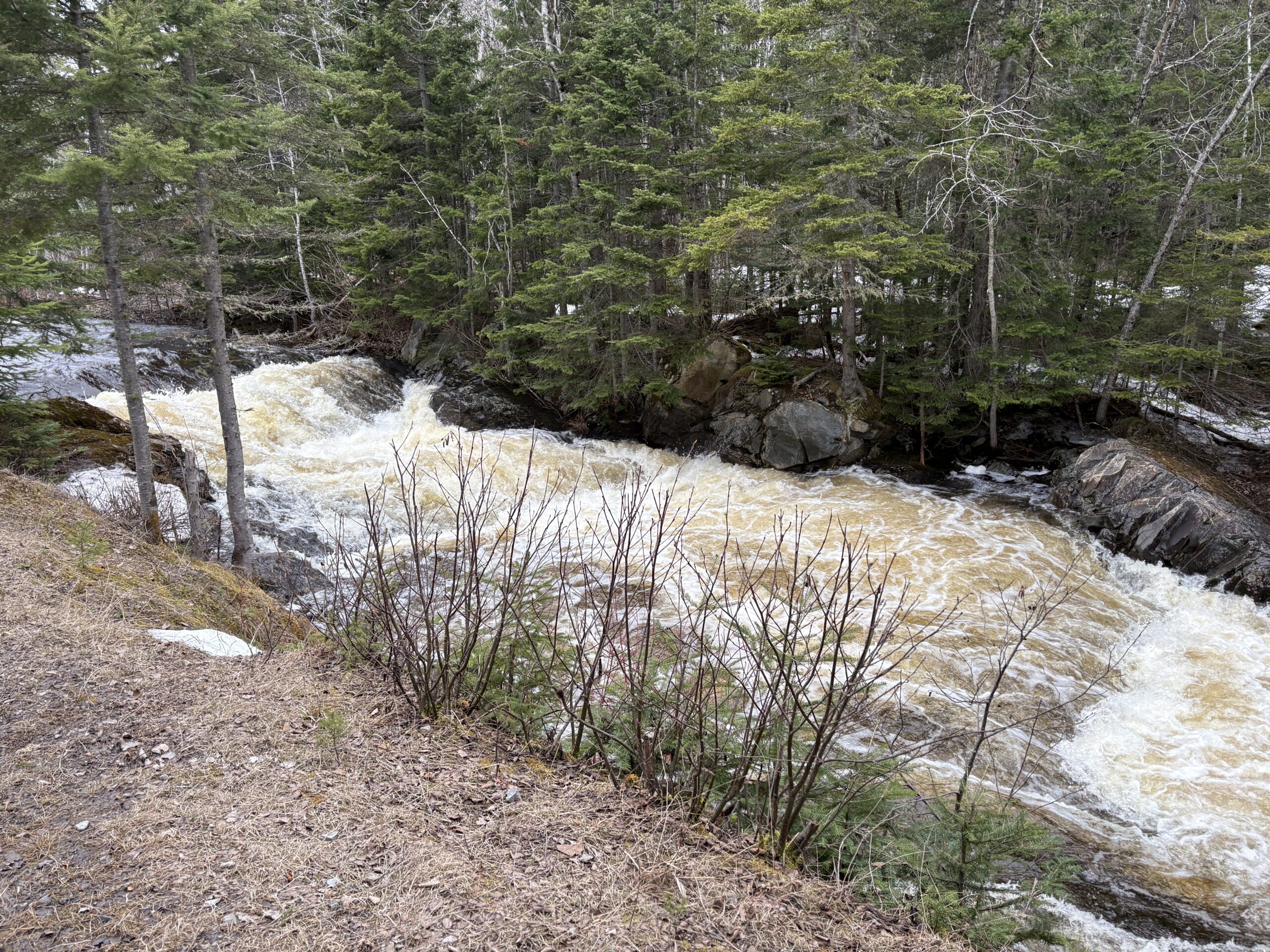
Grog Brook Falls
Located directly on the Northern Quad Route (Trail #10), this small falls with deep rust-coloured water pools is a beautiful spot along the trail to stop, take a few photos, and just listen to the soothing sounds emanating from the brook. The picture above was taken in the spring when water levels are high. By the way, if you have an NB fishing license then this is a great place to cast in your line for some fresh brook trout.
Brook Location: Lat: 47.80487 Lon: -67.14757