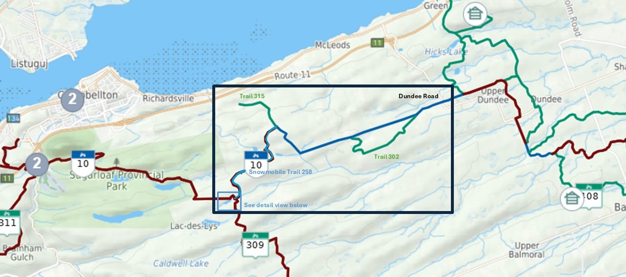
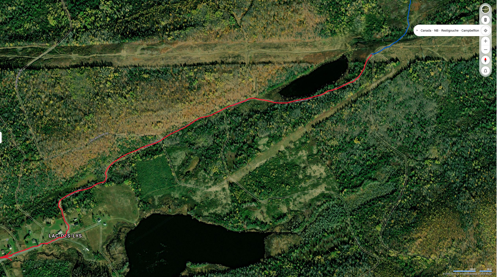
Local Trail
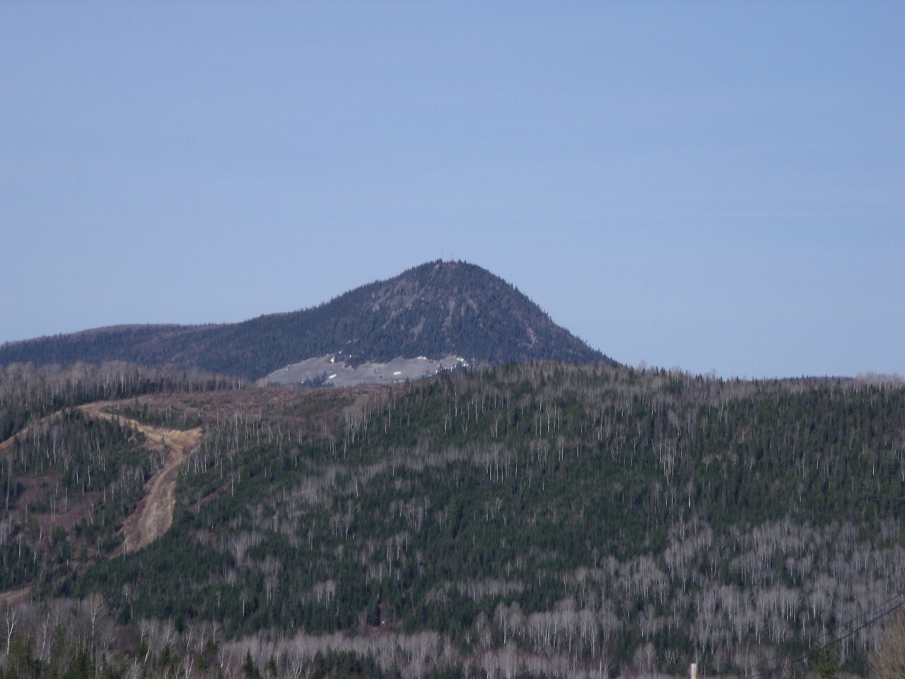
Meto'mquijuig Mountain
Meto'mquijuig Mountain is an attraction well worth the 9 kms detour off the Northern Quad Route (Trail #10). This detour allows you to ride directly to the top of the mountain (400m / 1300ft) following a steep, rocky but manageable trail that can be navigated even by novice riders. At the top of the mountain, you will be treated with a breathtaking view of the valley floor and untamed forests. During the ATV season, riders can get to the mountain by following the offseason snowmobile Trail #234, which branching off from ATV Trail #10 near Upsalquitch, NB.
Mountain Location: Lat: 47.88257 Lon: -66.88628
Local Trail
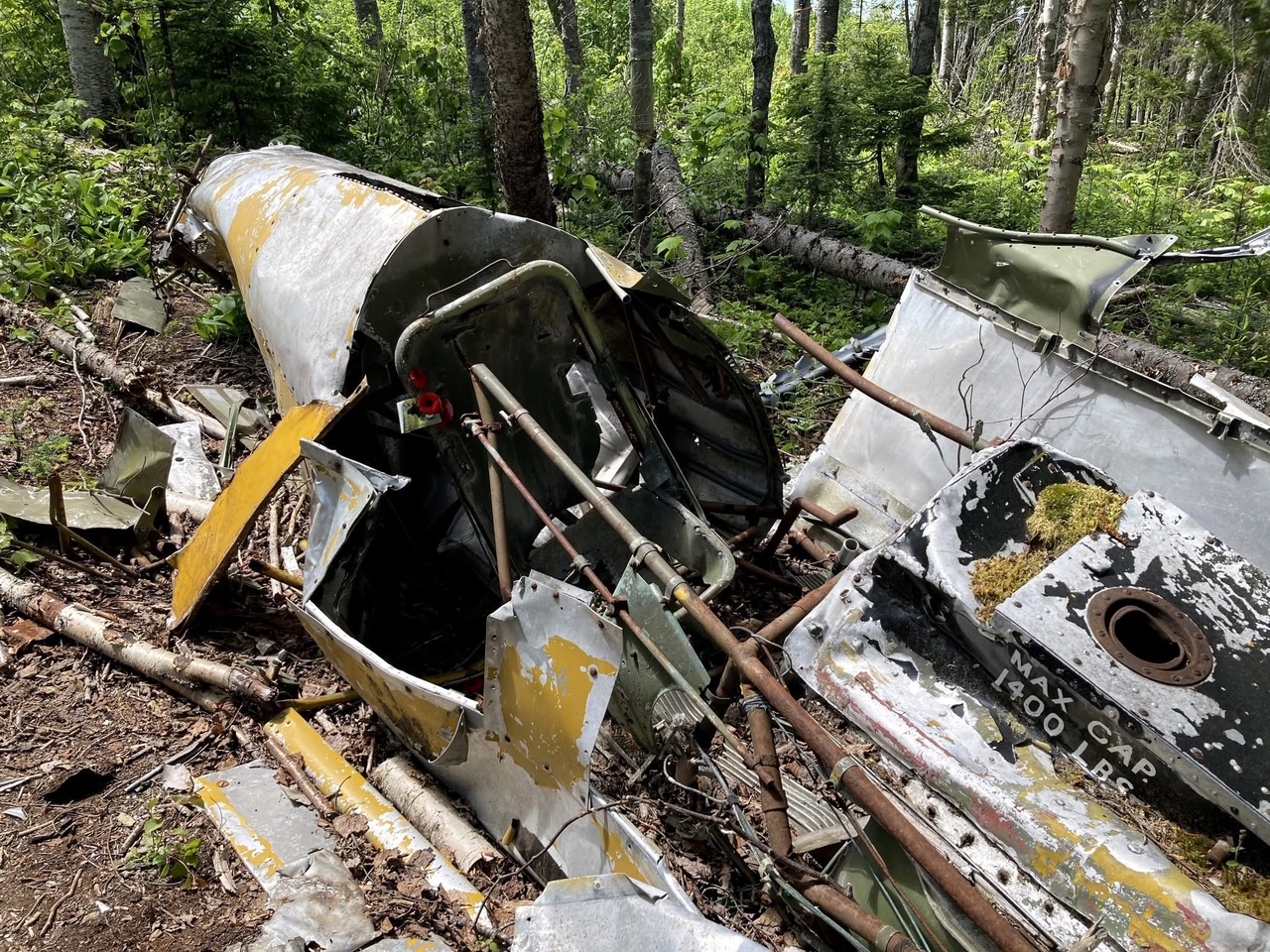
1957 Plane Crash Site
Although well outside the area managed by Club 3, this day long adventure starts at the intersection of the Northern Quad Route (Trail #10) and managed Trail #309. After riding 8 km on Trail #309, you exit off the trail and onto a number of gravel roads that will take you 75 kms south to the site of a plane crash where pilot Elwyn Gail Behnke tragically lost his life while participating in a Spruce Budworm spray operation in 1957.
Once near the site, look along the side of the road for a trail entrance. A short hike through a field and woods (lined with ribbons) leads to the crash site. We ask that the site be left as is and no artifacts be removed. See below for a CBC video about the site.
Crash Site Location: Lat: 47.51027 Lon: -66.6294
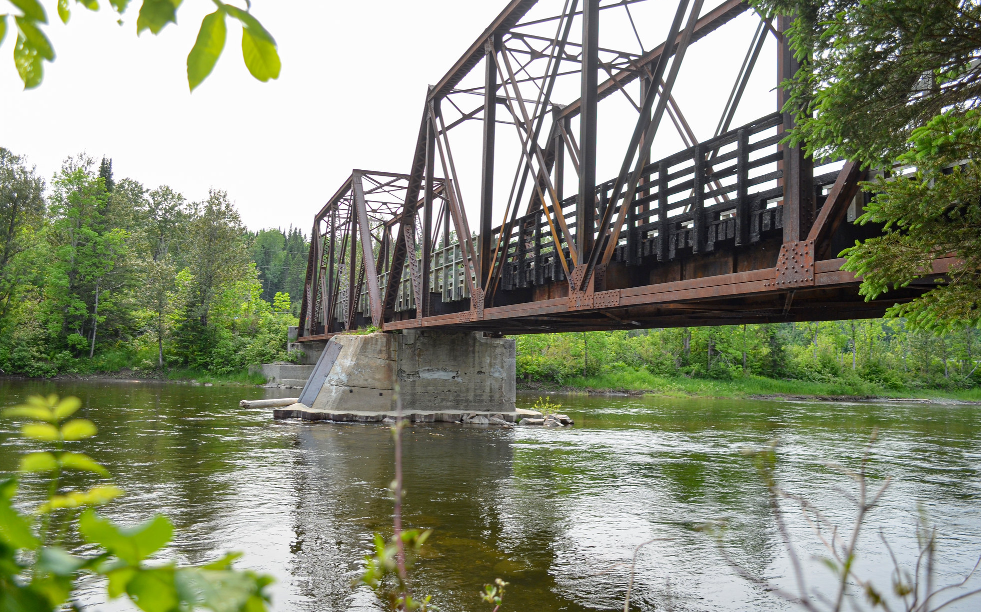
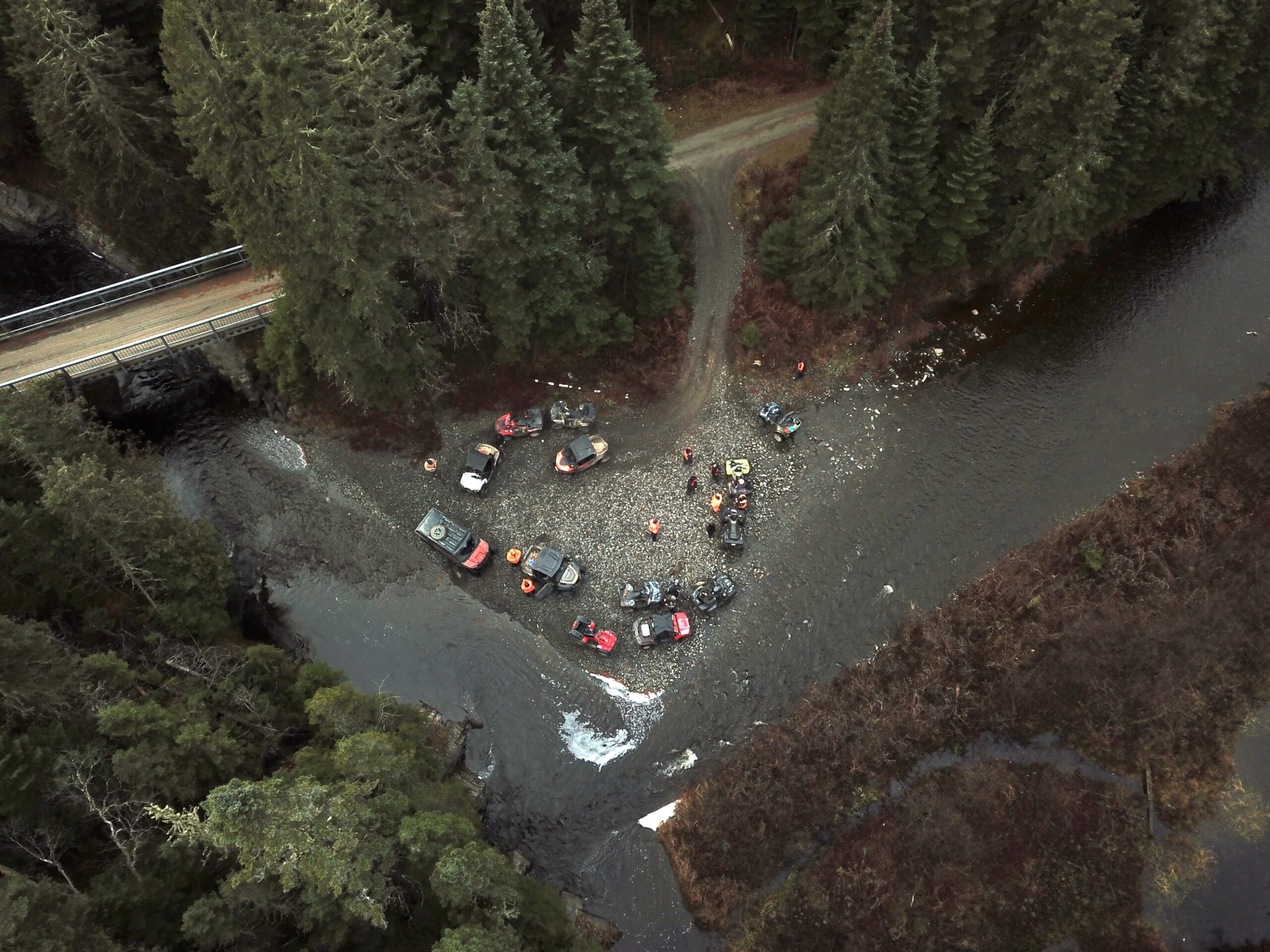
Upsalquitch River Bridge
The International Railway (INR) was in operation up to 1989, and during that time the Upsalquitch River bridge was the longest bridge span on the route. Years later, the bridge was repurposed to become a vital river crossing used by pedestrians, ATV'ers and snowmobiles. The bridge location is directly on the Northern Quad Route (Trail #10) near the town of Upsalquitch, NB.
Bridge Location: Lat: 47.832287 Lon: -66.887520
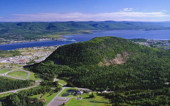
Sugarloaf Provincial Park
Sugarloaf Provincial Park offers and abundance of outdoor activities, including hiking trails around and up the Sugarloaf Mountain (300m / 1000ft). The park is very close to amenities for lodging, food, and fuel and the campground is a great place to stay and extend your visit. Sugarloaf Park is directly on the Northern Quad Route (Trail #10).
Park Location: Lat: 47.985156 Lon: -66.694511
Rest Area near Brook
Need a little break? This is a perfect place to stop and have a rest on the edge of a crystal-clear brook. The rest stop is directly on the Northern Quad Route (Trail #10), about 5 Kms from the train collision location.
Rest Stop Location: Lat: 47.81319 Lon: -67.04209
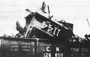
Train Collision Site from 1943
On May 29, 1943 train No 216 and train Extra 1160 West collided on the Inter-national Railway line (INR) near Upsalquitch, NB. As a result of the head-on collision, three men died instantly and a fourth died the next day in hospital. Nearly everyone on the trains including passengers on No 216 were injured, some serious. The site is located on the Northern Quad Route (Trail #10) near the town of Upsalqitch, NB. and a small monument has been erected at the site.
Collision Location: Lat: 47.81592 Lon: -66.97773
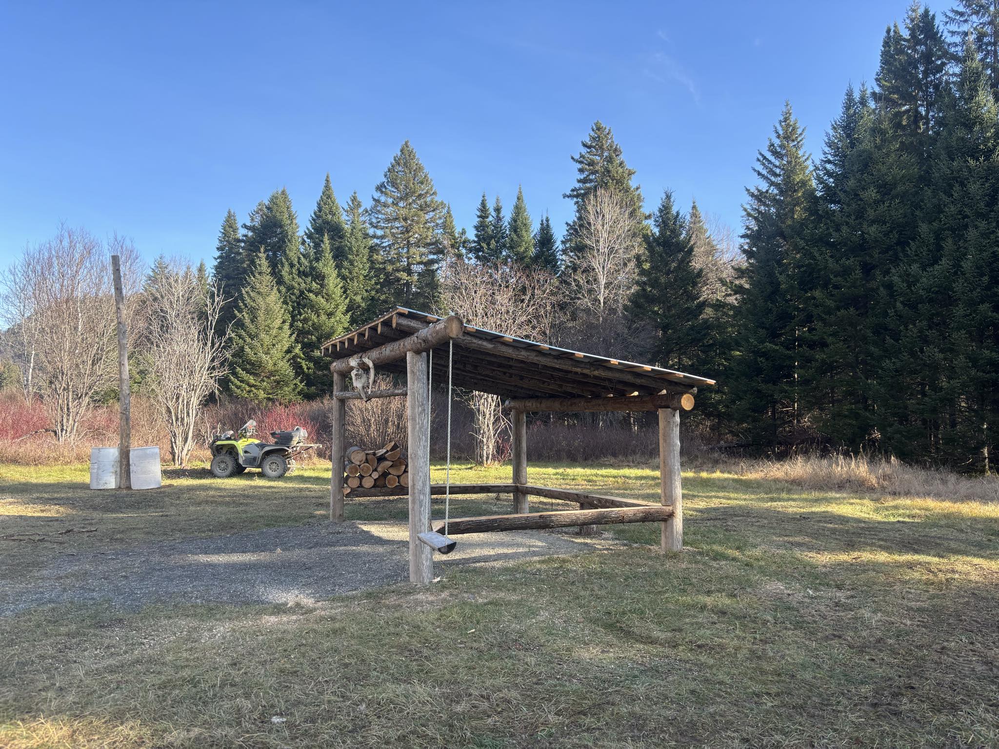
Rest Area "Au feu"
This beautiful open field rest stop located on Trial #10, is a perfect place to stop, take a break, cook some food or even just setup a few chairs around the provided fire pit and enjoy time with friends. This project was undertaken by several club members who spent their formative years in the area and wished to honour their heritage. The lean-too, named "Au feu" 🔥, was a two-year undertaking between site selection, permits and construction. The members constructed the shelter in 2025 with the entire project made possible through donations and local support.
Rest Stop Location: Lat: 47.91179 Lon: -66.82879